SDG&E Announces Alternative Routes — Only One of Four Bypasses Temecula
This week, SDG&E also announced the three alternative routes it will file along with the preliminary route that it disclosed in May. Only one of the four routes SDG&E will be submitting to the CPUC bypasses Temecula.
The interactive map of the preliminary route (green) and alternatives (red, yellow, blue) can be viewed at www.goldenpacificpowerlink.com.
Save Temecula's statement on SDG&E's proposed routes
SDG&E has a responsibility to identify and evaluate the least impactful route, a responsibility it has failed to fulfill. SDG&E has repeatedly told the Temecula community that the preliminary route disclosed in May is not final and that community feedback would help shape the project. Yet, this week, SDG&E announced that it plans to submit four routes when it files with the CPUC later this year — and only one avoids Temecula.
California has the technology and expertise to lead the nation in modern infrastructure. There are numerous alternatives to spending billions of ratepayer dollars on massive overhead extra-high-voltage transmission lines that will be outdated by the time they are completed. We should be advancing safer, smarter, less destructive alternatives, not defaulting to century-old models that impose enormous costs on ratepayers, residents, communities, and the environment.
The routes on a map
SDG&E publishes these routes only as static images. We built the interactive map below from those figures so the routes are easier to read — you can pan, zoom, and toggle each route on and off.
Map not loading? Open it in a new tab
You can also open the interactive route map in a new tab.
SDG&E's original figures (the static images our map is drawn from), all from goldenpacificpowerlink.com: Golden Pacific Powerlink fact sheet (PDF) · all four routes — overview map · Temecula close-up.
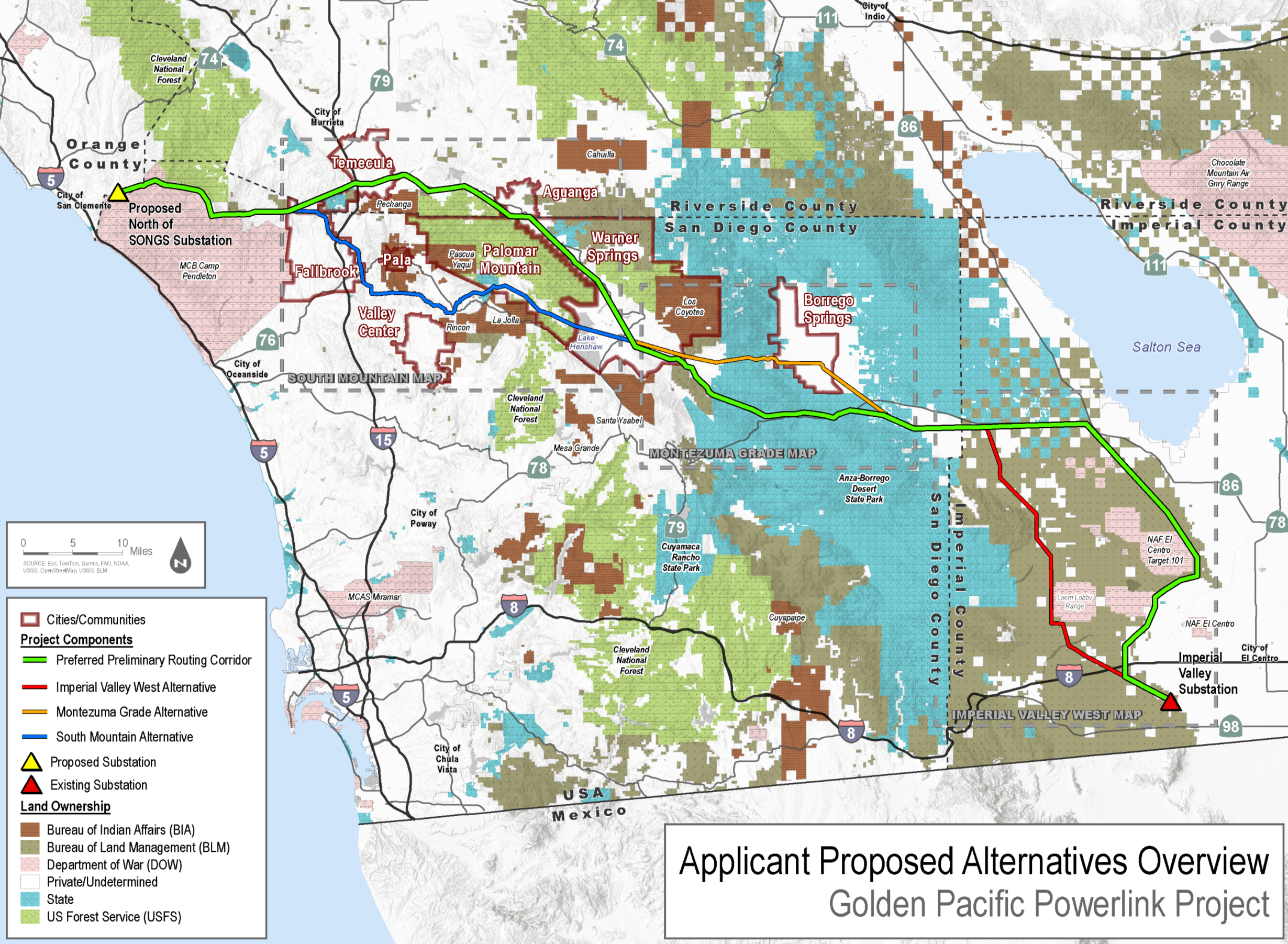
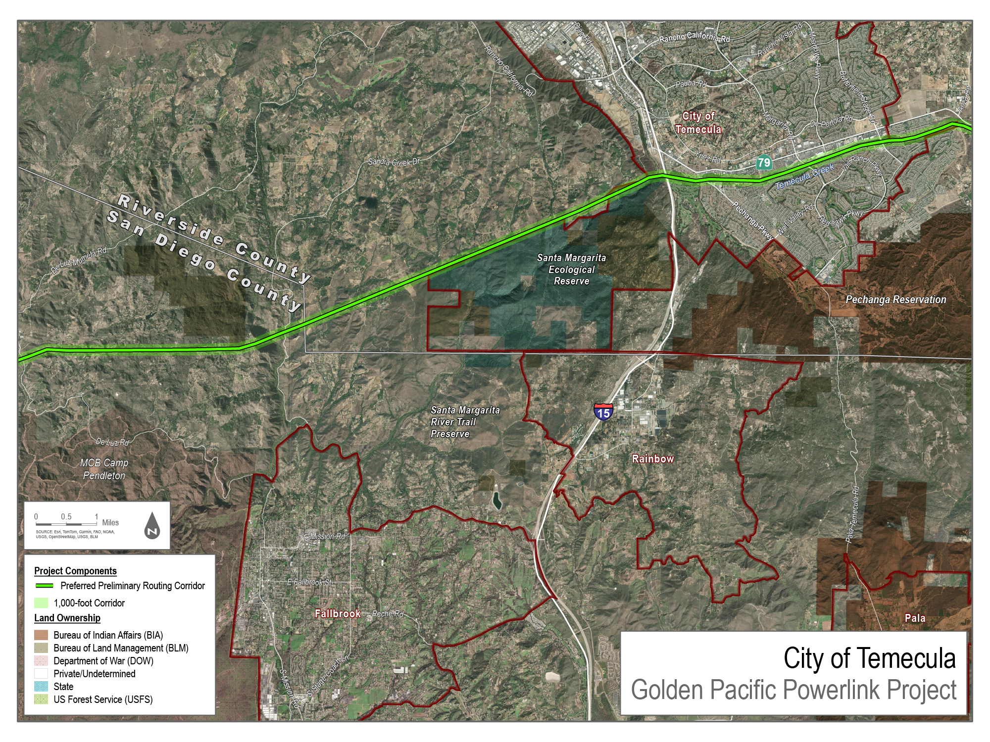
About this map: it is a reasoned overlay, not a survey. The lines shown are preliminary study corridors, not a final or surveyed route — they were traced from SDG&E's own published route figures (SDG&E releases those as images, not map data), so the map shows each corridor's location and shape but is not precise enough to read exact distances off it or to tell whether an individual parcel falls in or out. SDG&E has not yet filed with the California Public Utilities Commission (CPUC), and the CPUC — not SDG&E — will ultimately select the route. What is drawn is a corridor within which an alignment could be chosen, not a right-of-way, an easement, or a property line. For anything at the street or parcel level, wait for the georeferenced route SDG&E files with the CPUC.